LOOSE CANNON

Share this post

User's avatar
LOOSE CANNON
New Sat Image Shows Extent of Aussie's Progress More Than Three Years Later

New Sat Image Shows Extent of Aussie's Progress More Than Three Years Later

Inch by Inch, Couple Brings 'Anna Marie' Closer to a Launch

Peter Swanson's avatar
Peter Swanson
Sep 08, 2023
∙ Paid
6

Share this post

User's avatar
LOOSE CANNON
New Sat Image Shows Extent of Aussie's Progress More Than Three Years Later
6
1
Share
This Google Earth satellite image was taken on July 19, 2023, and shows the trail made by dragging Anna Marie from her starting point. The self-recovery effort began several months after she was stranded on Great Abaco by Hurricane Dorian in August 2019.

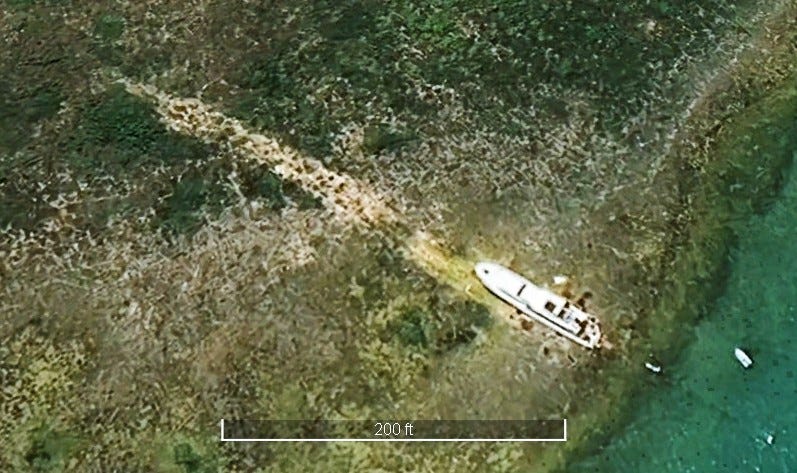
26°10.393N 77°13.513W

The irony is that Anna Marie is often surrounded by water now, but that’s actua…

Keep reading with a 7-day free trial

Subscribe to LOOSE CANNON to keep reading this post and get 7 days of free access to the full post archives.

Already a paid subscriber? Sign in
© 2025 Substack Inc
Privacy ∙ Terms ∙ Collection notice
Start writingGet the app
Substack is the home for great culture

Share