Carolinas Wind Farm Plan Advances as Study Cites Impact on Marine Radar
As Many as 175 Turbines At Intersection of Ship Lanes and Cruising Route
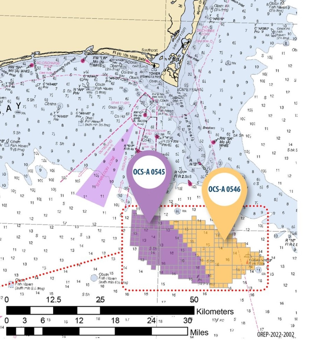
With the leasing yesterday of a huge swath of seabed just off the coast of North and South Carolina, the federal government has set the stage for a potential radar spoof zone at the intersection of shipping lanes into the Cape Fear River and the popular offshore run for recreational vessels bound from Charleston to Beaufort.
The Carolina Long Bay auction awarded two companies an area totalling 110,091 acres in the Wilmington East Wind Energy Area. If developed to capacity, turbines will generate 1.3 gigawatts of electricity, enough to power a half-million homes. Winning bids totalled $315 million.
Based on European wind-farm production data that would probably entail about 175 turbines.
A typical tactic for recreational vessels wanting to make time outside the Intracoastal Waterway is to make a 226-mile passage from Charleston to the inlet at Morehead City. That would take the boat in between the shallowest part of Frying Pan Shoal and the wind farm leaseholds. Their adjacency to the entrance channel to Cape Fear River is clearly shown on the chart above (soundings in fathoms).
Announcement of the auction results followed the release earlier this year of a 94-page report from the National Academies of Science warning about the effects of massed turbines on vessel radar:
Keep reading with a 7-day free trial
Subscribe to LOOSE CANNON to keep reading this post and get 7 days of free access to the full post archives.


